What the valley is made of
The bowl of La Paz is cut into a deep pile of sediment left by rivers, ice and mountain slopes over the last few million years — geologists call the main unit the La Paz Formation, and the layers above it record the arrival of glaciers and the rivers that drained them. It is not solid rock. It is silt, clay, sand and gravel, packed hard enough to stand in cliffs, soft enough that a fingernail scratches it. Every hillside in the city is that material; the whole town is built on it.
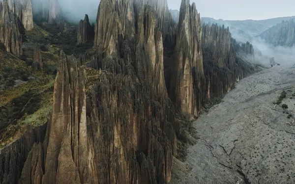
At the south-eastern edge of the city the bed is unusually thick and unusually exposed. That is Valle de las Ánimas.
How rain makes needles
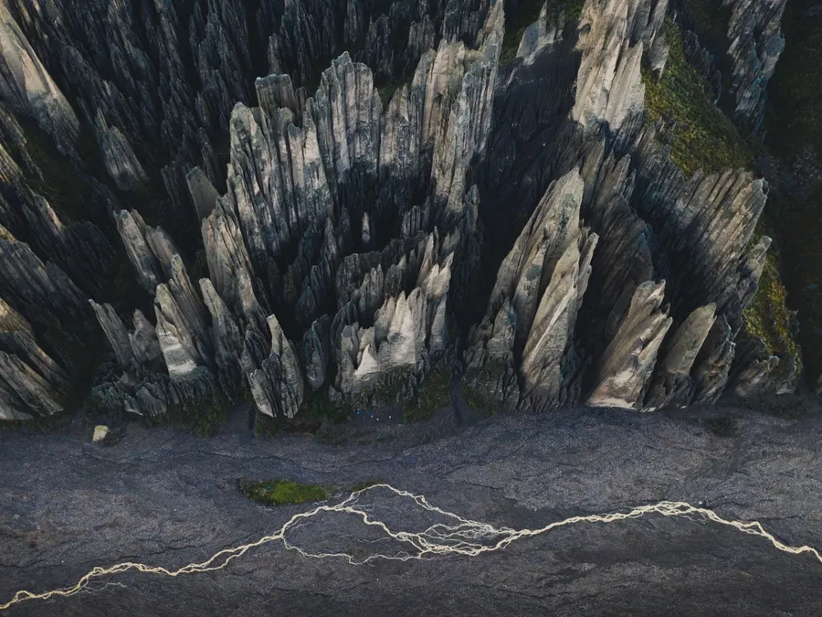
Erosion is not even. Where the surface is uniform, rain wears it down as a slope. Where something harder sits on top — a stone, a lens of gravel, a layer cemented by minerals — the rain runs off it and cuts the soft material on either side instead. The harder piece becomes a cap, the column under it survives, and the ground between columns keeps dropping.
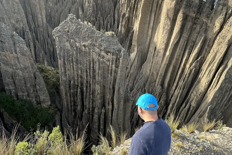
Look for the caps: many spires still carry theirs, a darker pebble or crust on the very top. When the cap finally falls, the needle underneath loses its protection and goes quickly — a few rainy seasons can round it into a stump. Meanwhile, the gullies between the spires are deepening and new columns are being isolated from the slopes behind. The valley is not a finished object. It is a process caught mid-way.
Why here, and why so tall
Three things line up in this valley. The sediment bed is thick, so there is a lot of vertical room to carve. It is exposed on a steep slope, so water runs fast and cuts rather than pools. And it sits on the wet, east-facing side of the city, where the rainy season (December to March) delivers the heaviest afternoon storms. Valle de la Luna, on the drier southern side, is the same material with a thinner bed and gentler slopes — smaller, rounder shapes.
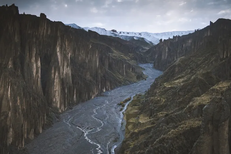
The dry riverbed at the bottom is the other half of the story: it is where everything that erodes ends up. Walk it after a storm and you are walking on last week's spires.
What we know, and what nobody has measured
Honesty about the numbers: the sediment itself is old — the La Paz basin fills span the Pliocene into the Pleistocene, millions of years — but nobody has dated the spires as landforms precisely. What the valley shows on its own surface, and what the people who have watched it for decades say, is that the needles are young: hundreds of years, not thousands. If a geologist gives you a firmer figure, tell us and we will put it here with the source.
The valley has no single official name and sits across a disputed boundary between the municipalities of La Paz and Palca. It is a municipal protected area and a departmental natural monument all the same. The 10 Bs entrance at the chain goes to the local family that keeps the access.